


GAWR Segment 6 (Steel)
Distance
641 Mi.
(1,032 KM)Days
9
% Unpaved
54%
% Singletrack
0%
% Rideable (time)
100%
Total Ascent
16,987'
(5,178 M)High Point
2,361'
(720 M)Difficulty (1-10)
3?
- 2Climbing Scale Easy27 FT/MI (5 M/KM)
- 2Technical Difficulty Easy
- 3Physical Demand Fair
- 3Resupply & Logistics Fair
Contributed By

Dana McKnight
Guest Contributor
Dana is retired and passionate about bikepacking and multi-day touring adventures. He spends much of his time developing and exploring routes in West Virginia, where he grew up, and Virginia, where he now lives. In 2024 and 2025, Dana completed the Great American Wheel Route, one of his bucket-list goals, over the course of two years. You can find more recaps of Dana’s adventures at Gravel Ride Recaps on Ohio Gravel Grinders.
B/W photos by Cody Johnson; Color photos by Cody Johnson, Dana McKnight, Mike Miller, Luke Kocher, Jen Kelly, Mike Miller, Evan Deutsch, and Evan Finton
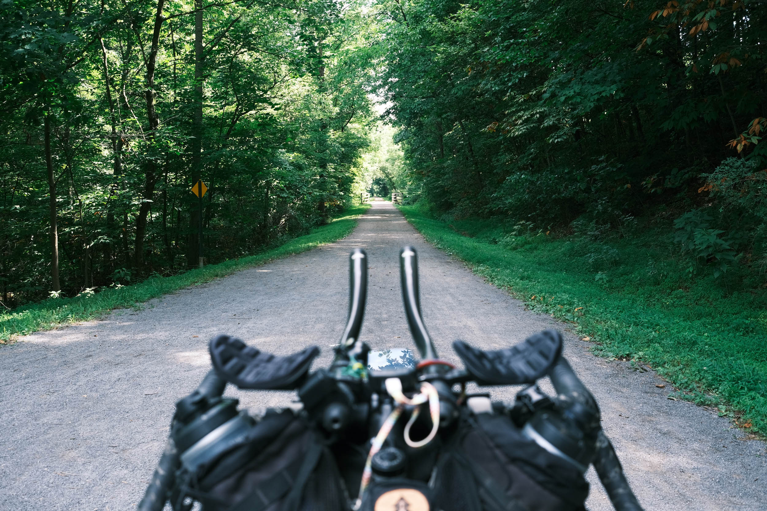
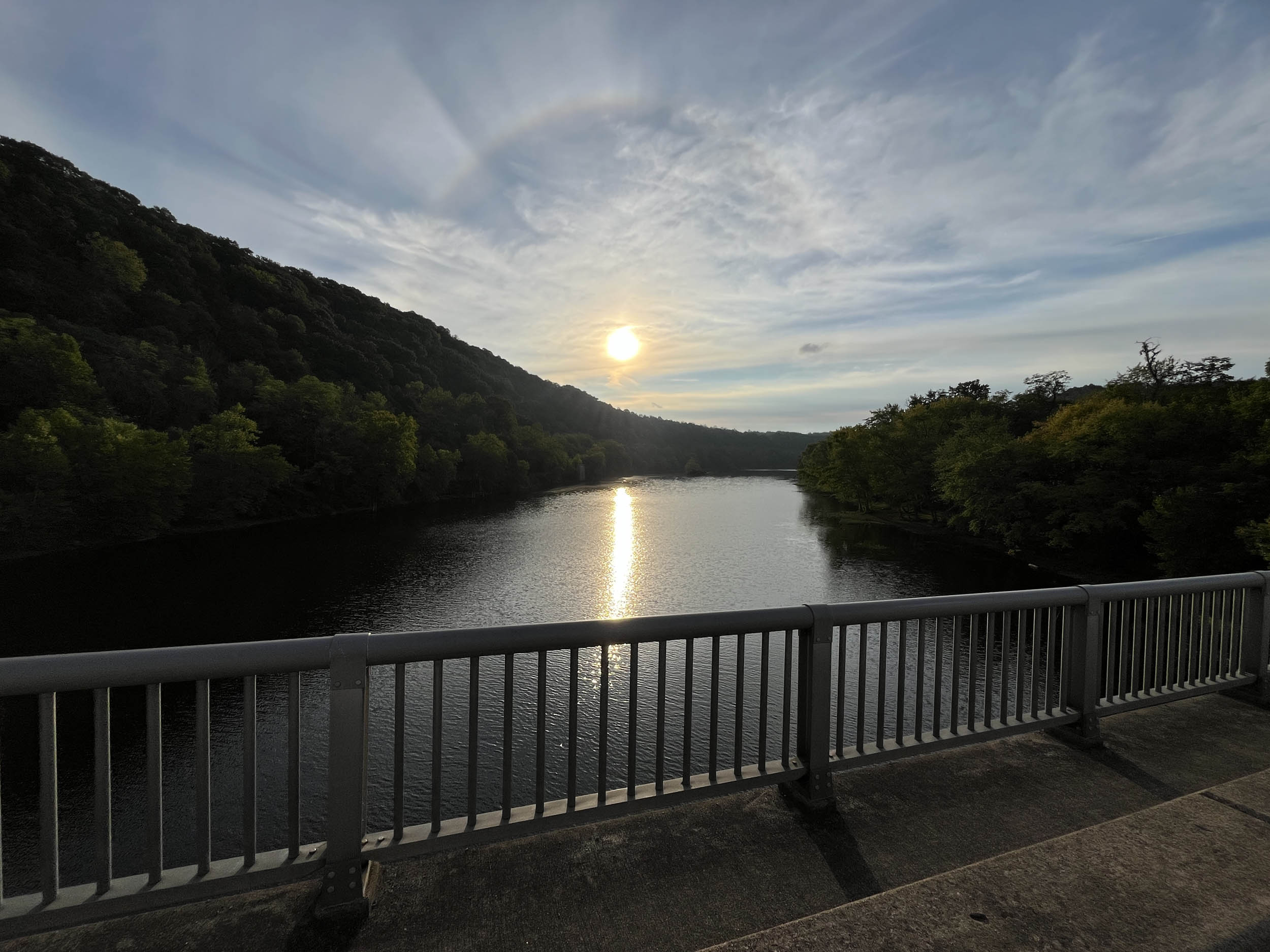
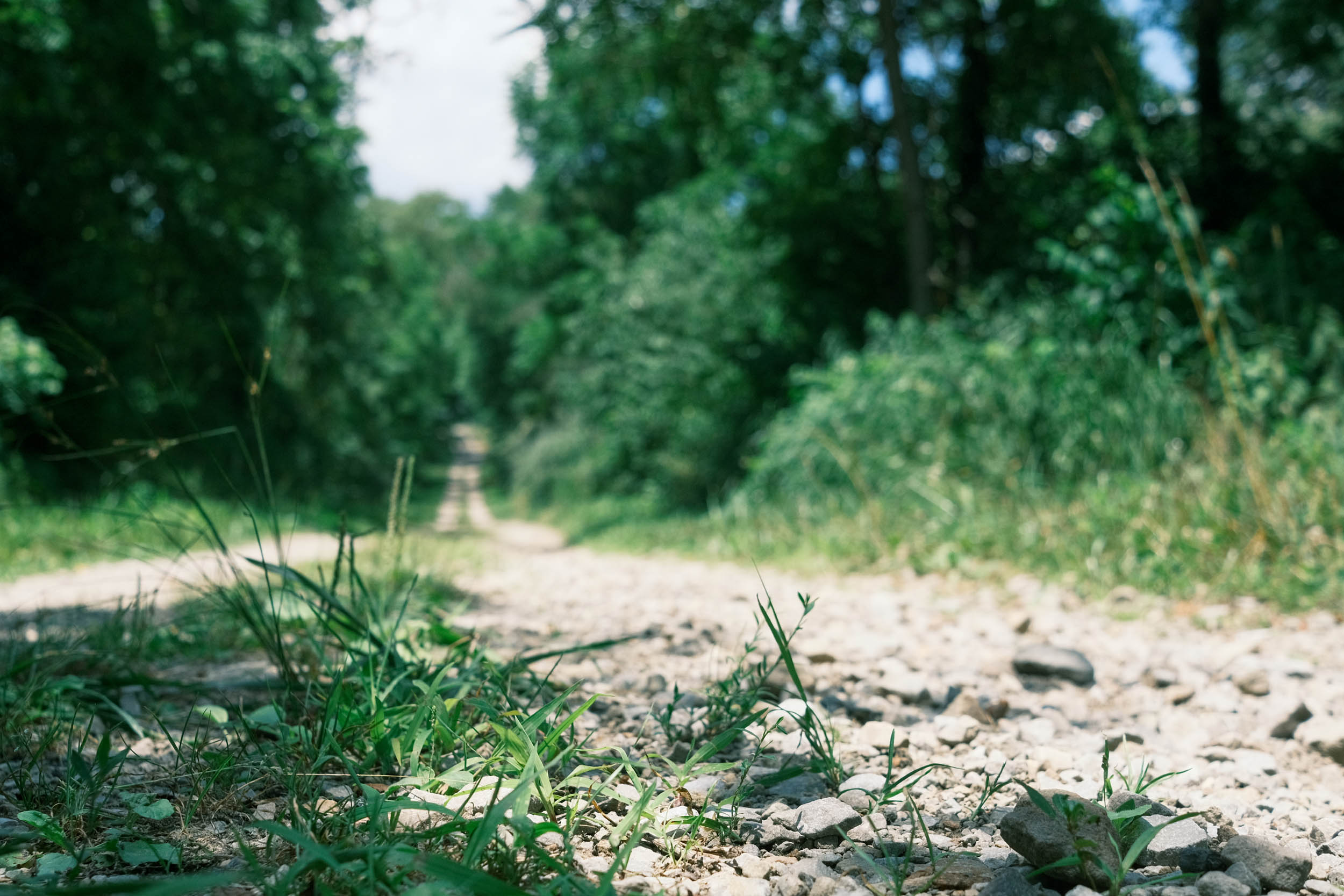
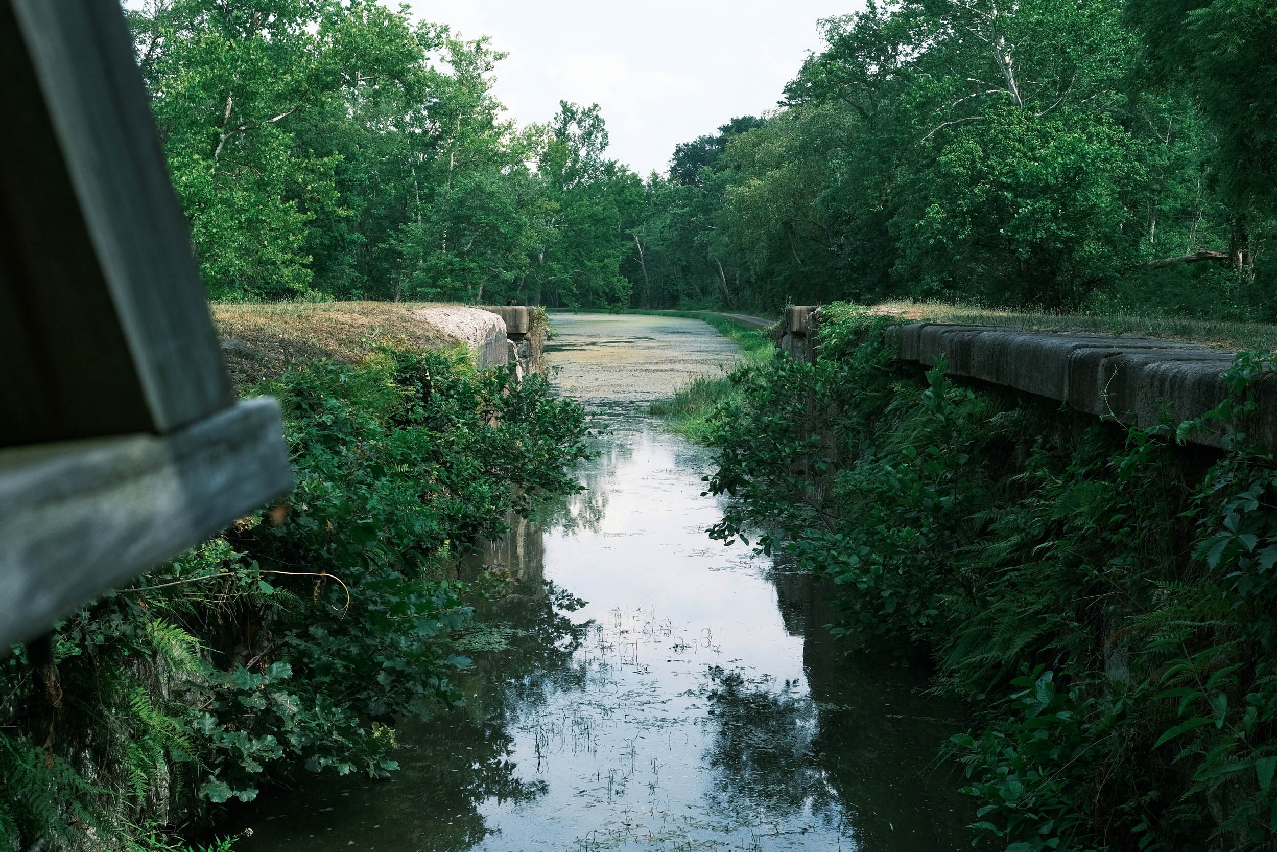
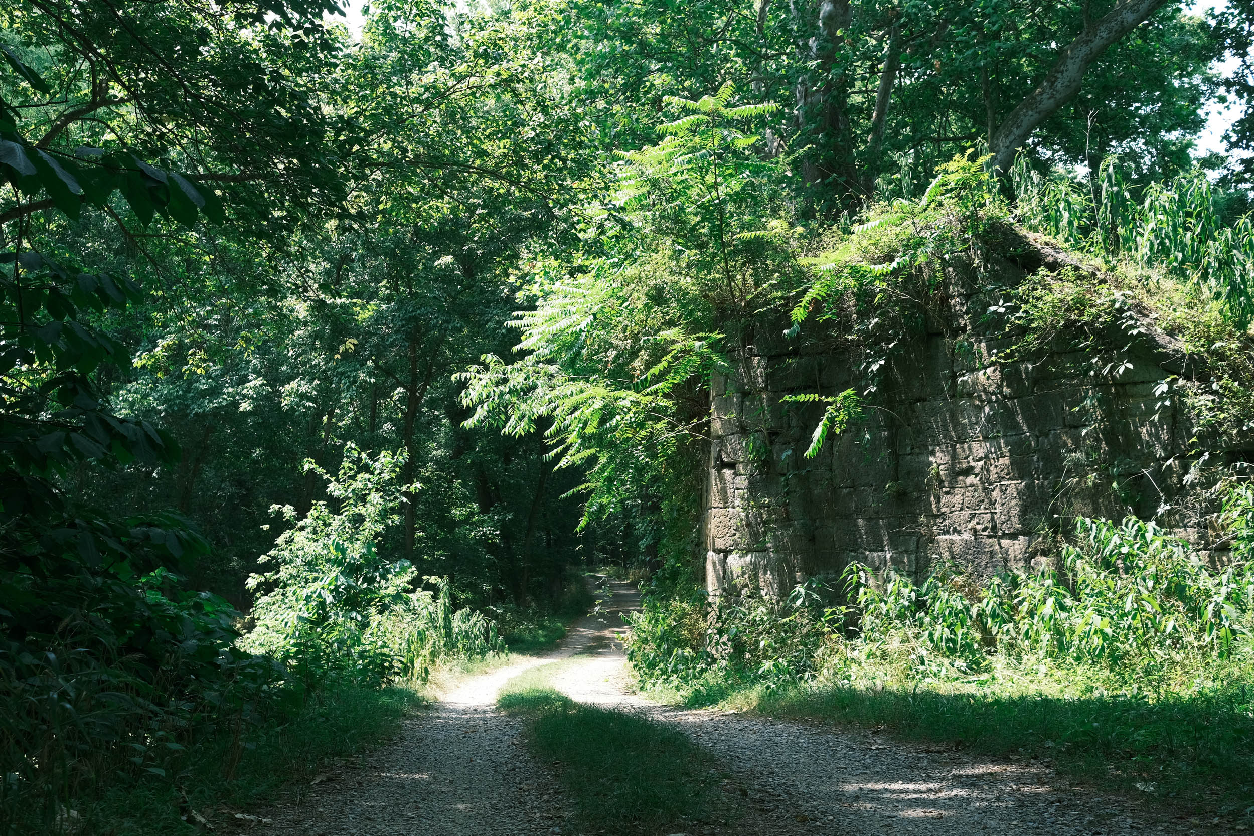
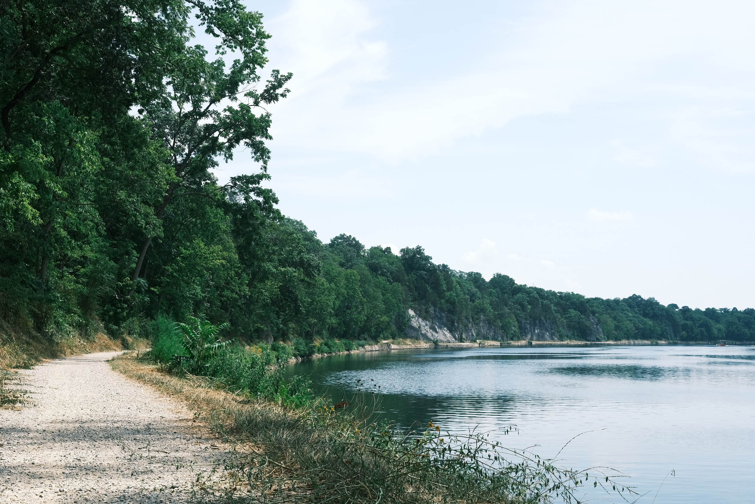
The flat part of the journey ends as you proceed on the final segment (Steel) of the Great American Wheel Route and enter the Appalachian Mountain region, which supplied the raw materials and factories that spurred the Industrial Revolution. This area was a major supplier of coal, coke, and iron, which were forged into steel, with many of those materials extracted and transported along the abandoned railroads that form much of this segment. There are countless towns along the route where hard-working individuals extracted and delivered the ingredients for steel. Some towns continue to thrive, while others have been swallowed by time and nature, leaving only distant memories of the boom times. Extinct factories and remnants of the bustling railroads, which were the arteries of this area, are ever-present. If you look closely, you may be able to find some of the old coke ovens that produced the fuel for the blast furnaces that smelted the steel, earning this region the nickname “The Industrial Heartland.”
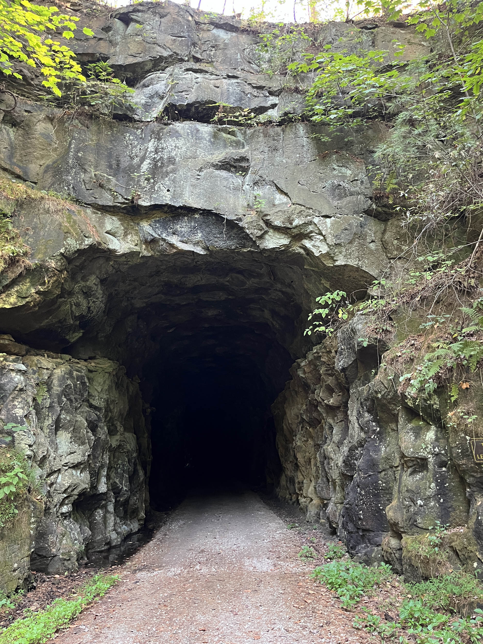
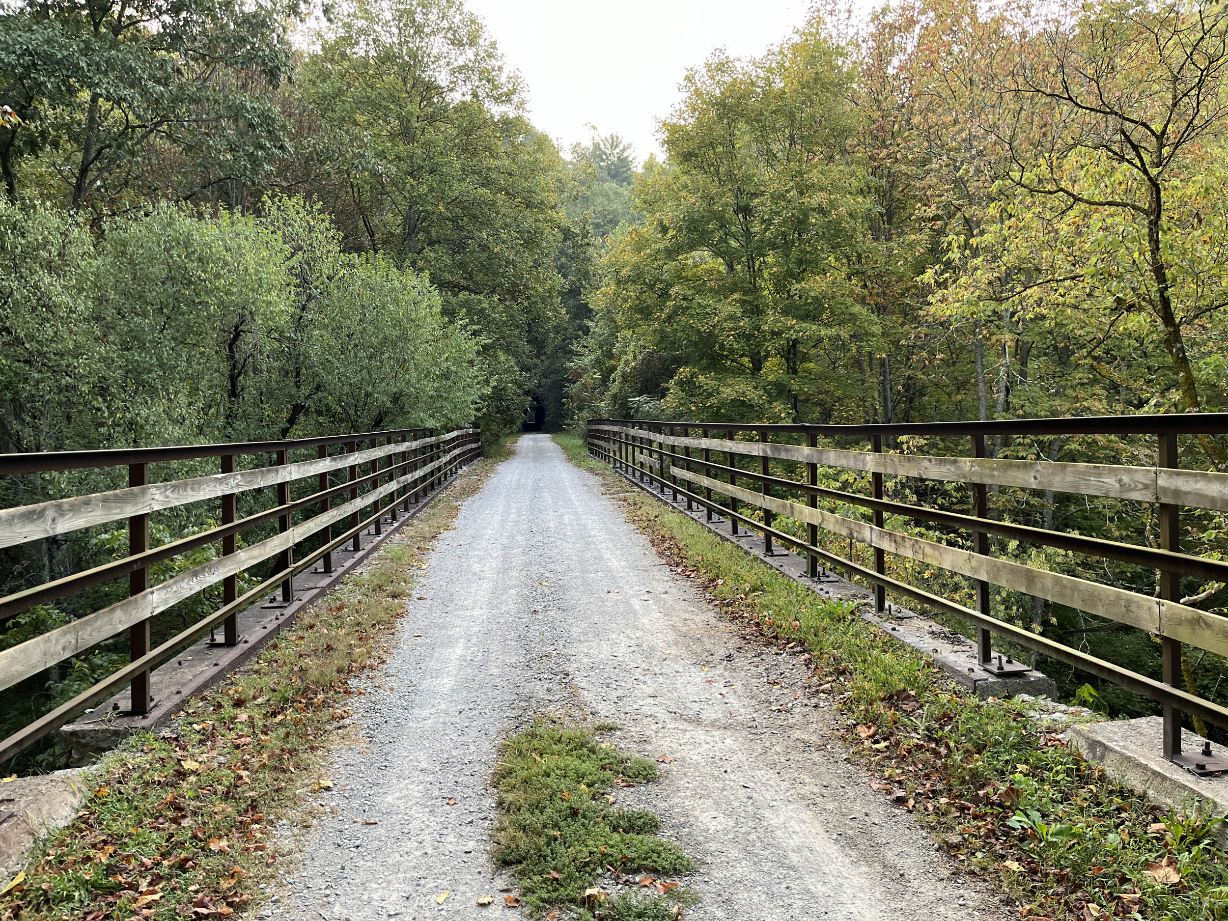
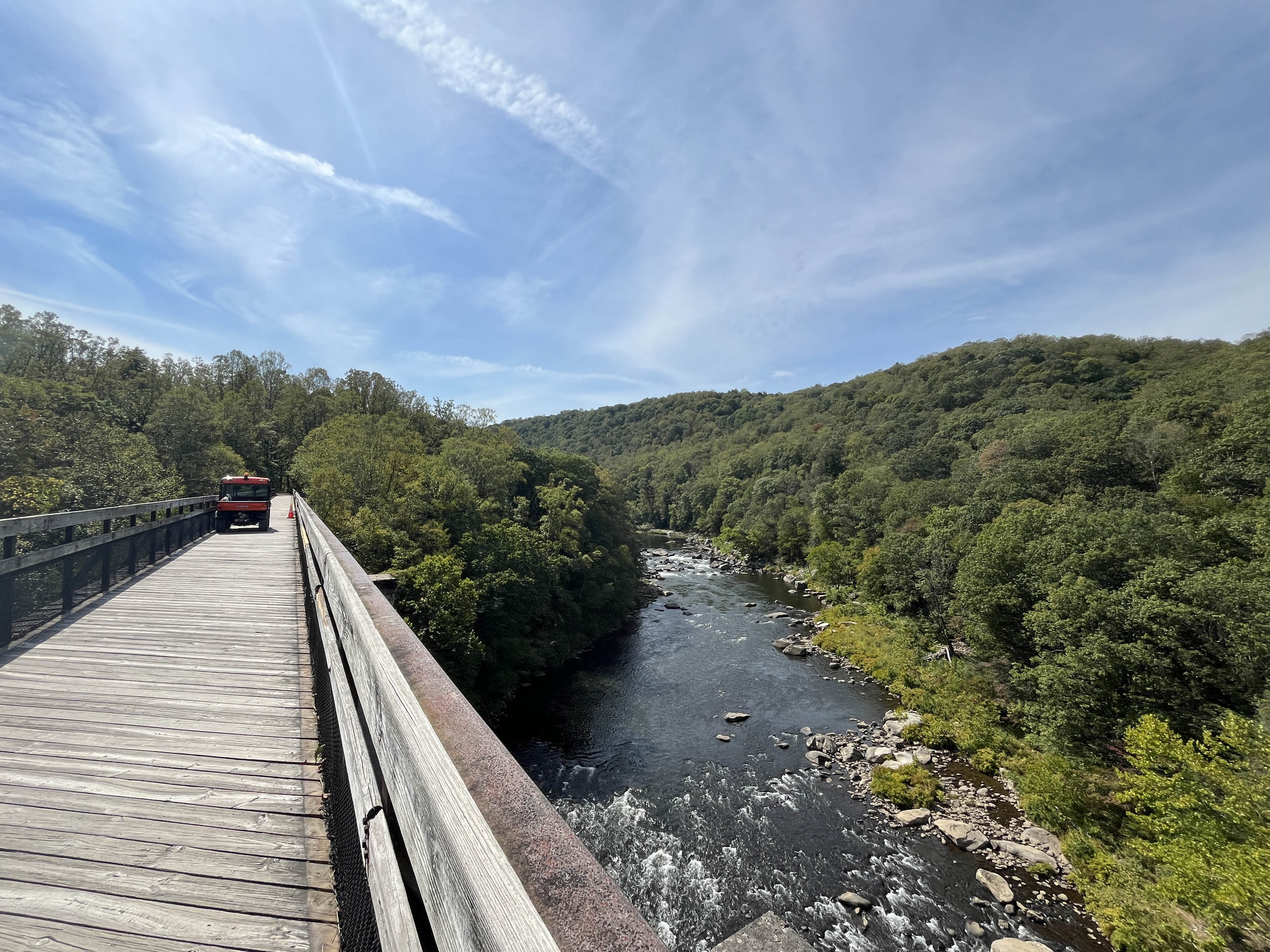
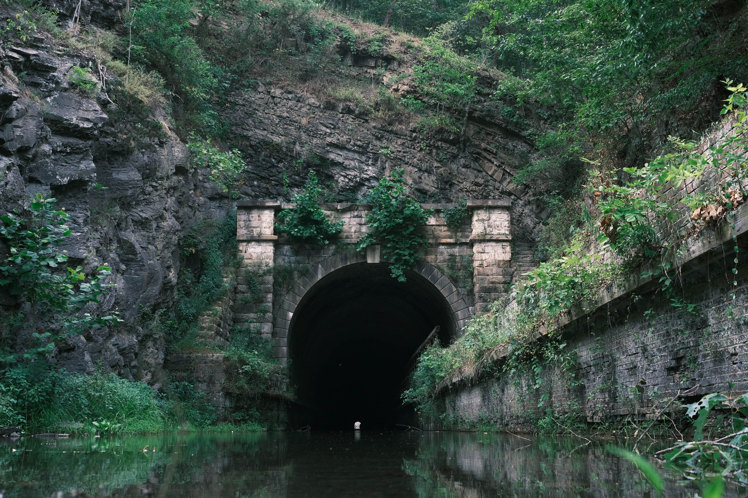
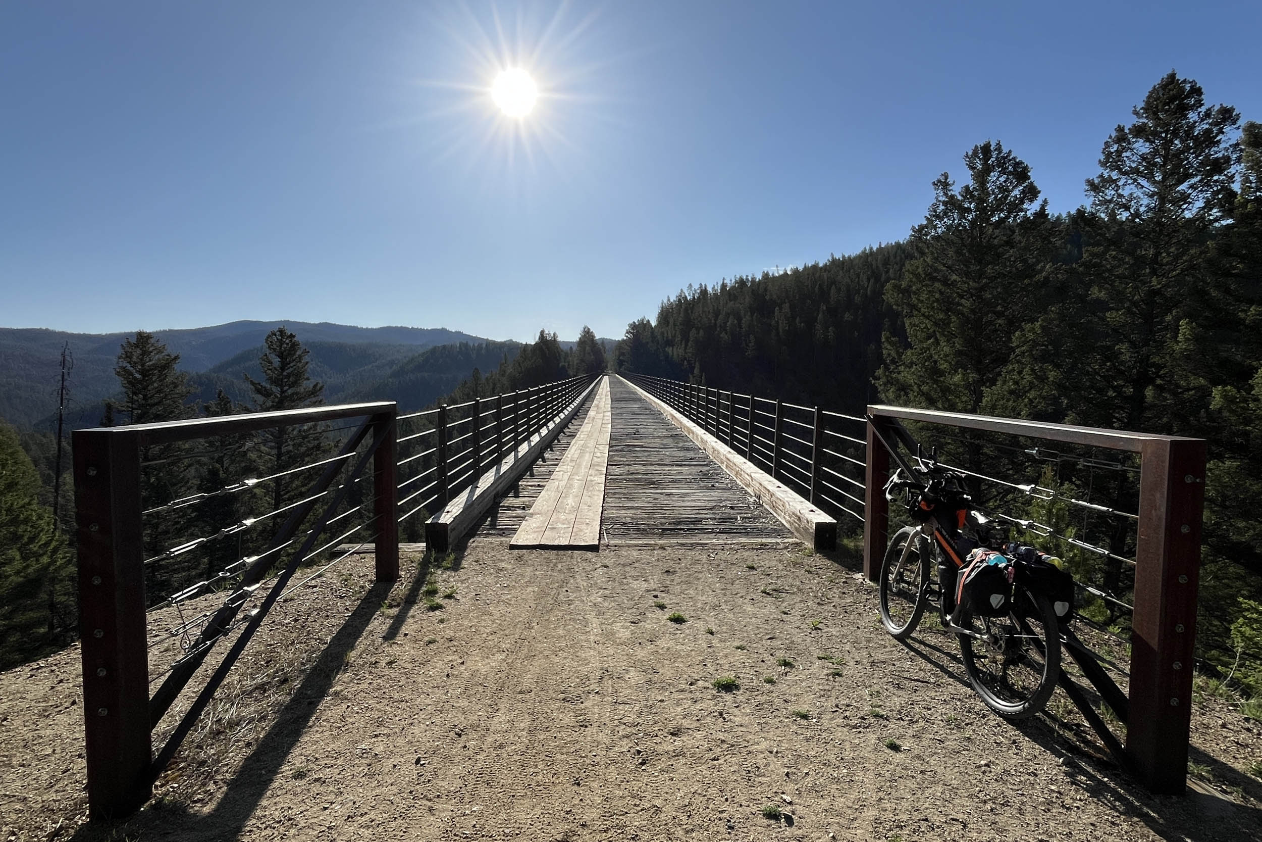
The Appalachian Mountains are not as big and majestic as the Rockies, but you will experience some of the steepest climbs of the route here. Luckily, large parts of the route are relatively flat because the developers of the old railroads discovered that the best way through the mountains was to tunnel right through them. You’ll experience 17 tunnels and hundreds of bridges, both built from the very steel and iron that was transported on the old railroads on this segment. Most tunnels are unlit, so make sure you have lights.
Enjoy the West Virginia favorite, pepperoni rolls, invented by Italian immigrants who worked the coal mines around Clarksburg and Fairmont, West Virginia. The rolls provided a quick, convenient, and delicious lunch while working in the mines. They have continued to grow in popularity, becoming ubiquitous in West Virginia while being readily available in most convenience stores. If timed correctly, the route passes through Italian bakeries in Clarksburg, so it is possible to enjoy this delicious handheld meal fresh from the bakery.
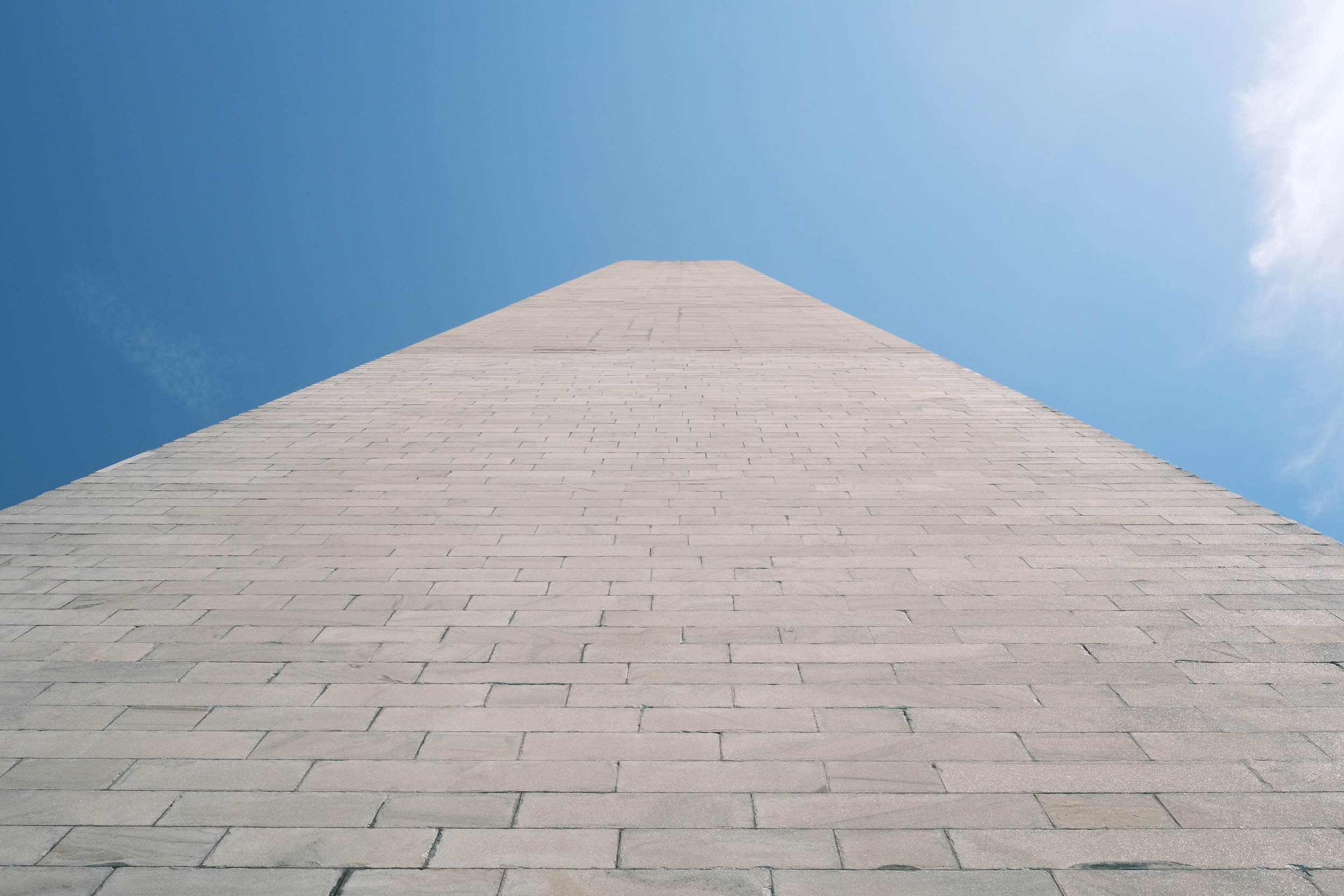
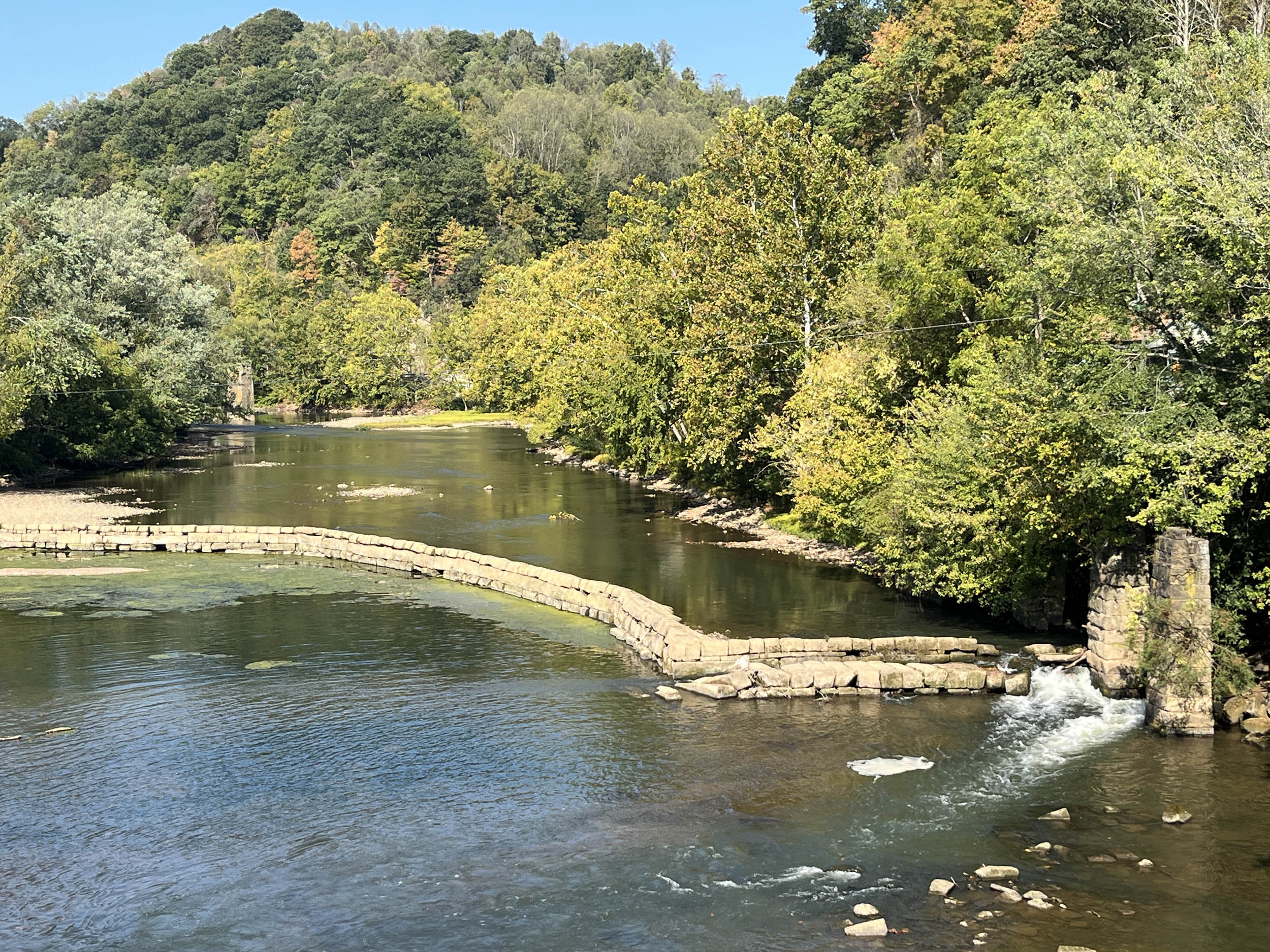
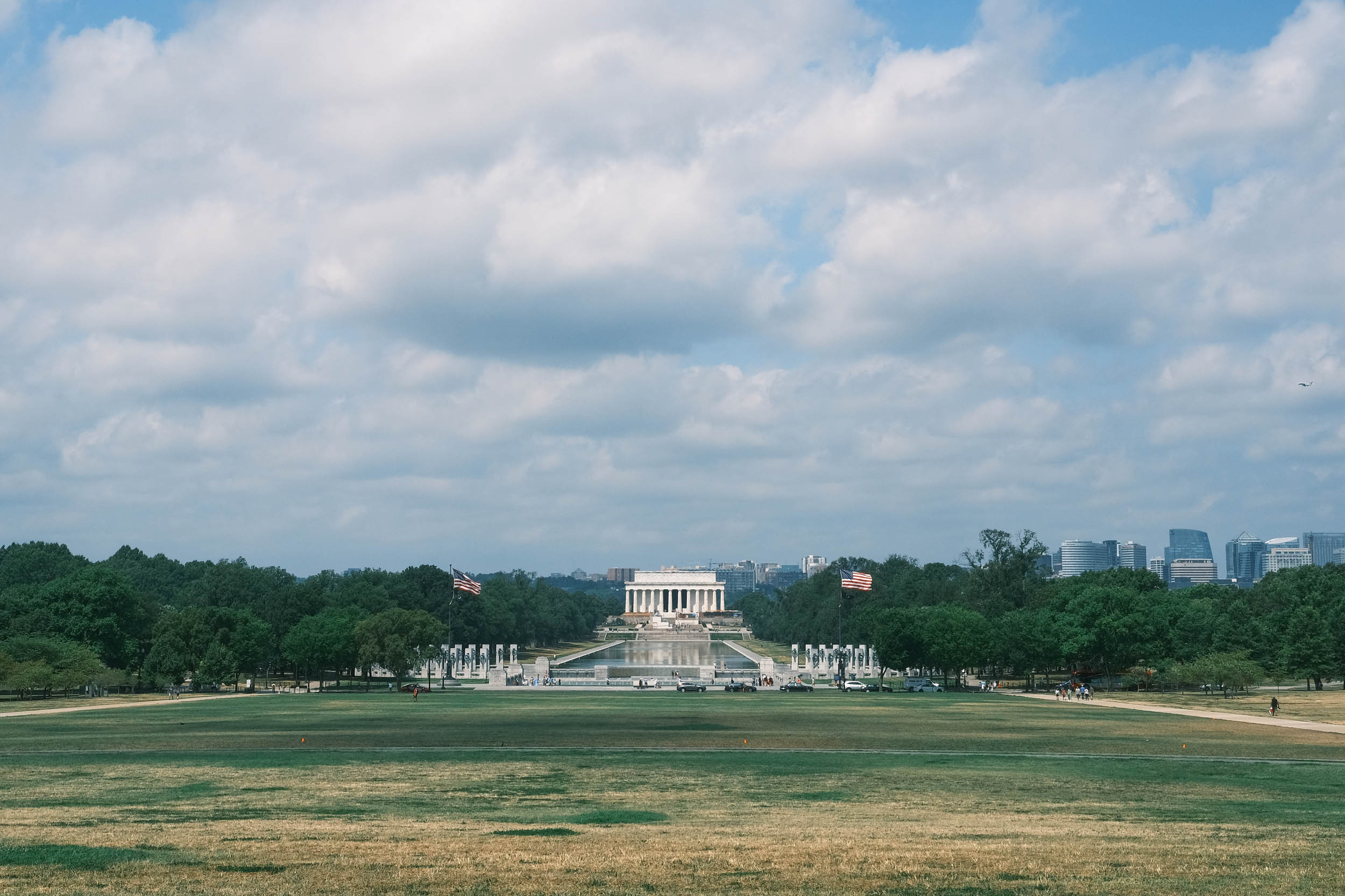
The grand finale of the route takes you along the amazing Great Allegheny Passage (GAP) and C&O Canals, where you can learn how the railroad, coal, and steel industries were all intertwined on the GAP and how the canal was the lifeblood of commerce during the early days of the United States. These trails link together, providing over 300 miles of easy riding all the way to the bustling nation’s capital, Washington, DC, where you’ll end your epic adventure at the Washington Monument.
Route Difficulty
We are assigning an overall difficulty of 3 to this segment due to its sheer length. The segment is relatively easy to ride due to the abundant number of rail trails and canals, but there are some very steep but short climbs (20%+ grade) in south central Ohio and western Pennsylvania that will challenge your climbing ability.
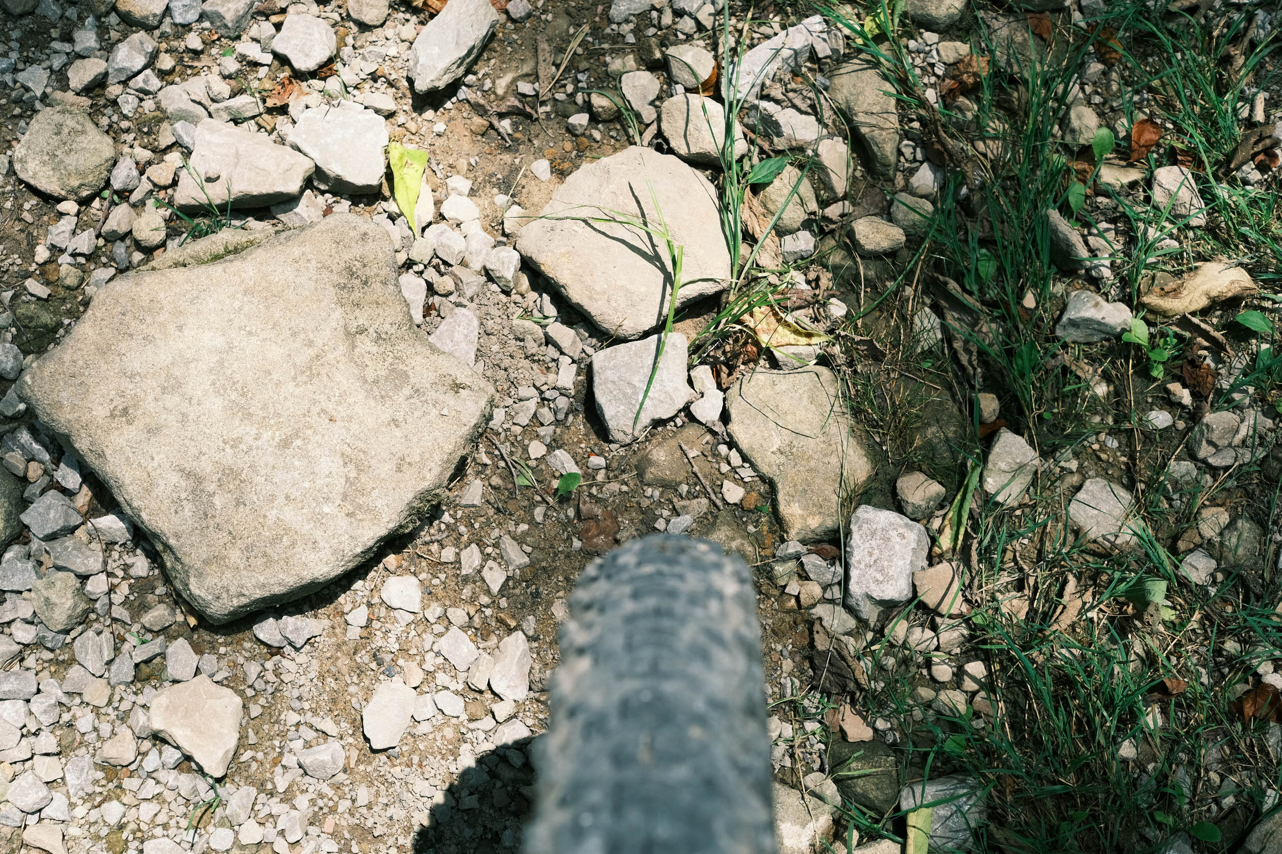
Overall, the segment is not extremely technical, but there are some rough gravel sections. The segment follows many rail trails, so climbing is limited, though you can experience the high end of railroad grade of around 4%. There are short but very steep grades in a few areas that will challenge the body.
Resupply and logistics are mostly straightforward, as the segment passes through small towns and resupply points. Transport to and from Dayton, OH, and Washington, D.C., is readily available by air, bus, or rental car. Mass transit is available in Washington, D.C. There are also several bike shops in both cities that will receive or pack your bike for transport.
One of the challenges is the ability to reroute due to weather, flooding, fire, construction, etc. Due to the length of the route, predicting these issues is nearly impossible, so having the skill to safely reroute yourself when the route is blocked is paramount.
The Great American Wheel Route (GAWR) is an expansive 3,700-mile mixed-terrain bicycle route traversing the United States. Beginning at the Space Needle in Seattle and concluding at the Washington Monument in Washington, D.C., the GAWR guides riders across the country via an elaborate network of gravel roads and paths, paved trails, and low-traffic backroads, prioritizing separation from motorized vehicles. Find the full GAWR route here.
Route Development: The GAWR was finalized in 2024, with many people contributing to its creation and maintenance. It was inspired by and incorporates multiple segments of Rails to Trails Conservancy’s Great American Rail Trail (GART) route, linking them with dirt to create a more gravel-focused experience across the country. Find details at the main route page here.


Submit Route Alert
As the leading creator and publisher of bikepacking routes, BIKEPACKING.com endeavors to maintain, improve, and advocate for our growing network of bikepacking routes all over the world. As such, our editorial team, route creators, and Route Stewards serve as mediators for route improvements and opportunities for connectivity, conservation, and community growth around these routes. To facilitate these efforts, we rely on our Bikepacking Collective and the greater bikepacking community to call attention to critical issues and opportunities that are discovered while riding these routes. If you have a vital issue or opportunity regarding this route that pertains to one of the subjects below, please let us know:
Highlights
Must Know
Camping
Food/H2O
Trail Notes
Resources
- Visit the small but exciting town of Chillicothe, Ohio where you can find excellent food in the historic downtown area.
- Riding through the many varieties of tunnels along the segment with the majority of them located on West Virginia’s rail trails.
- Passing through the campus of Ohio University in Athens, Ohio where you can see the vibrant campus and it’s football stadium right on the banks of the Hocking River.
- Visit The Ridges in Athens, Ohio. An old lunatic asylum converted to an art museum and part of the Ohio University system.
- Take a paddle wheeler ferry over to Blennerhassett Island and Mansion in Parkersburg, WV and explore the history of the islands early 1800’s political inhabitants.
- Visit The Cairo Bank Museum in Cairo, West Virginia. A unique building and Office of the North Bend Rail Trail Foundation that includes a small museum where you can be fascinated by the complexity and craftmanship of everyday antique office tools such as pencil sharpeners, hole punches and staplers.
- Visit the campus of West Virginia University in Morgantown, West Virginia home of the Mountaineers.
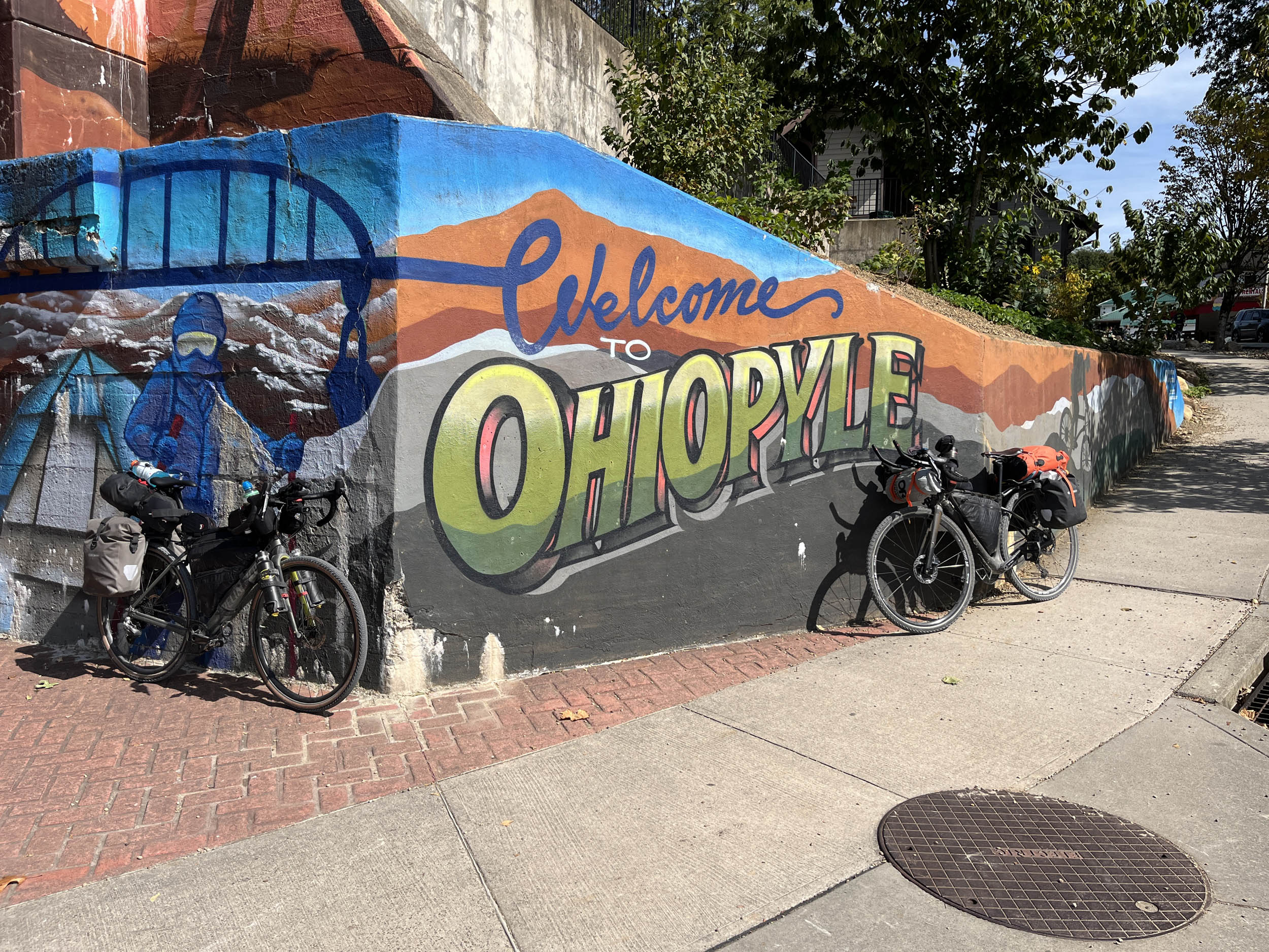
- Stay awhile in Ohiopyle, Pennsylvania and take a rafting trip down the Youghiogheny River.
- Visit Falling Waters – a Frank Loyd Wright architectural masterpiece that is more art than building.
- Ride across the Keystone Viaduct a 910 feet long 100 foot high steel bridge on the Great Allegheny Passage east of Myersdale.
- Ride through the 3300 foot long Big Savage Tunnel and then take a break viewing the expansive landscape at Big Savage Lookout.
- Explore the history and antique structures along the C&O Canal National Park.
- Visit the hallowed ground of Antietam National Battlefield where the bloodiest day of fighting in American History took place.
- Take a moment and see The Great Falls of the Potomac where the massive river drops over a series of impressive waterfalls.
- After completing your adventure, spend a few days in DC seeing the many world-renowned monuments and museums.
When to go
- Late spring to early fall – The big Savage Tunnel closes in November and opens in April of each year due to weather. The GAP is not passable when the tunnel is closed.
Dangers and Annoyances
- Dogs – dogs may be encountered anywhere along the route especially in rural areas where owners don’t properly contain them. It is recommended that you carry pepper spray, an air horn, etc. to help deter them. Dogs have been encountered in rural Washington, Montana, Ohio and West Virginia but can be found anywhere.
- Ad-hoc route deviations – The ability and skill to reroute due to flooding, fires, weather, construction, etc. will enhance your ride and improve your odds of completing the adventure.
Travel basics
- Dayton, Ohio airport or Reagan National in DC. Dulles in the DC area is an option and can be reached by the Metro public transit system that allows bicycles on its trains. Bicycles on Metrorail | WMATA
- U.S. Visa requirements – U.S. Tourism & Visit Visa
What bike?
- Any comfortable endurance, gravel, adventure, touring type bike that can carry your gear and is durable. You will most likely experience mechanicals due to the length and gravel conditions of the route. Know basic skills and be able to find a bike shop when necessary. You may have to rig a solution until you get to the shop.
- Tire size – 40 mm to 2.2 inches with durable compounds and less aggressive tread patterns are recommended.
- Gearing – at least a 1:1 gear ratio between the crank and cassette for the lowest gear. Lower is better.
- Suspension – many riders have completed the route without any suspension components. Stem and seat suspensions may provide additional comfort depending on riders’ preferences. Knowing how to and when to adjust your tire pressure for different riding conditions is probably more important than having suspension components.
- Campgrounds and established campsites are readily available along many portions of this segment especially along the North Bend Rail Trail in West Virginia, the Great Allegheny Passage (GAP) Rail Trail in Pennsylvania and the Chesapeake and Ohio (C&O) Canal National Park in Maryland. Many other prominent options are noted in the downloadable GPX file and the available services spreadsheet, but there are more.
- Due to the limited amount of public lands in this segment, dispersed camping and National Forest Campgrounds are very limited.
- If wild camping is a must, we recommend setting up after dusk and leaving at dawn. Churches, parks, and other public places are usually safe options, but use your own judgment and leave no trace.
- Camping is a challenge across the approximately 90 miles between Clarksburg, West Virginia and Connellsville, Pennsylvania
- There are hotels/motels/lodging in Washington Courthouse, Chillicothe, Athens, OH, Parkersburg, Ellenboro, Morgantown, WV, Connellsville, Ohiopyle, Confluence, Rockwood, Myersdale, PA, Frostburg, Cumberland, Hancock, Williamsport, Sharpsburg, MD, Harpers Ferry, WV, Brunswick, MD and Washington DC.
- Filtering water is normally not necessary on this segment of the route due to the abundant towns and cities along the route, however some filtering is possible especially when camping along the rail trails and the C&O canal.
- Water is available in most towns and riders have also asked local residents for water and most are more than happy to accommodate. Ask before using private water sources.
- There are a significant number of resupply options on this segment, as noted in the POIs of the downloadable GPX file and the available services spreadsheet.
- Churches are a good source of drinking water as there are usually spigots available. Make sure to ask if there is someone on site.
- The main resupply points with significant options are Washington Courthouse, Chillicothe, Athens, OH, Parkersburg, Ellenboro, Morgantown, WV, Connellsville, Ohiopyle, Confluence, Rockwood, Myersdale, PA, Frostburg, Cumberland, Hancock, Williamsport, Sharpsburg, MD, Harpers Ferry, WV, Brunswick, MD and Washington DC.and the many small towns along the route.
There are a few recommended places for food and drink. West to East include:
- The massive portions of delicious and fresh Asian cuisine at the Hometown Hibachi in Chillicothe, OH
- Enjoy the friendly service, affordable prices, and large portions of chicken at the multi-generation owned Miller’s Chicken in Athens, OH.
- Fill your tummy with a chilly dog and root beer at The Root Beer Shack in Parkersburg, WV
- Have a home cooked meal at Cheryl’s Country Diner in Parkersburg, WV
- Have a hearty country meal at Dodd’s Log Cabin Grill in Ellenboro, WV
- Sample a fresh West Virginia original pepperoni roll at D’Annunzio’s Bakery in North Clarksburg.
- Savor the key lime pie at Mikey C’s Cuisine in Fairmont, WV
- Enjoy original Italian food at Oliverio’s Ristorante and excellent wood fired pizza’s at Mountain State Brewing both right on the route in Morgantown, WV.
- Make sure to try the delicious hot Italian sub at JB’s Market in Dunbar, PA.
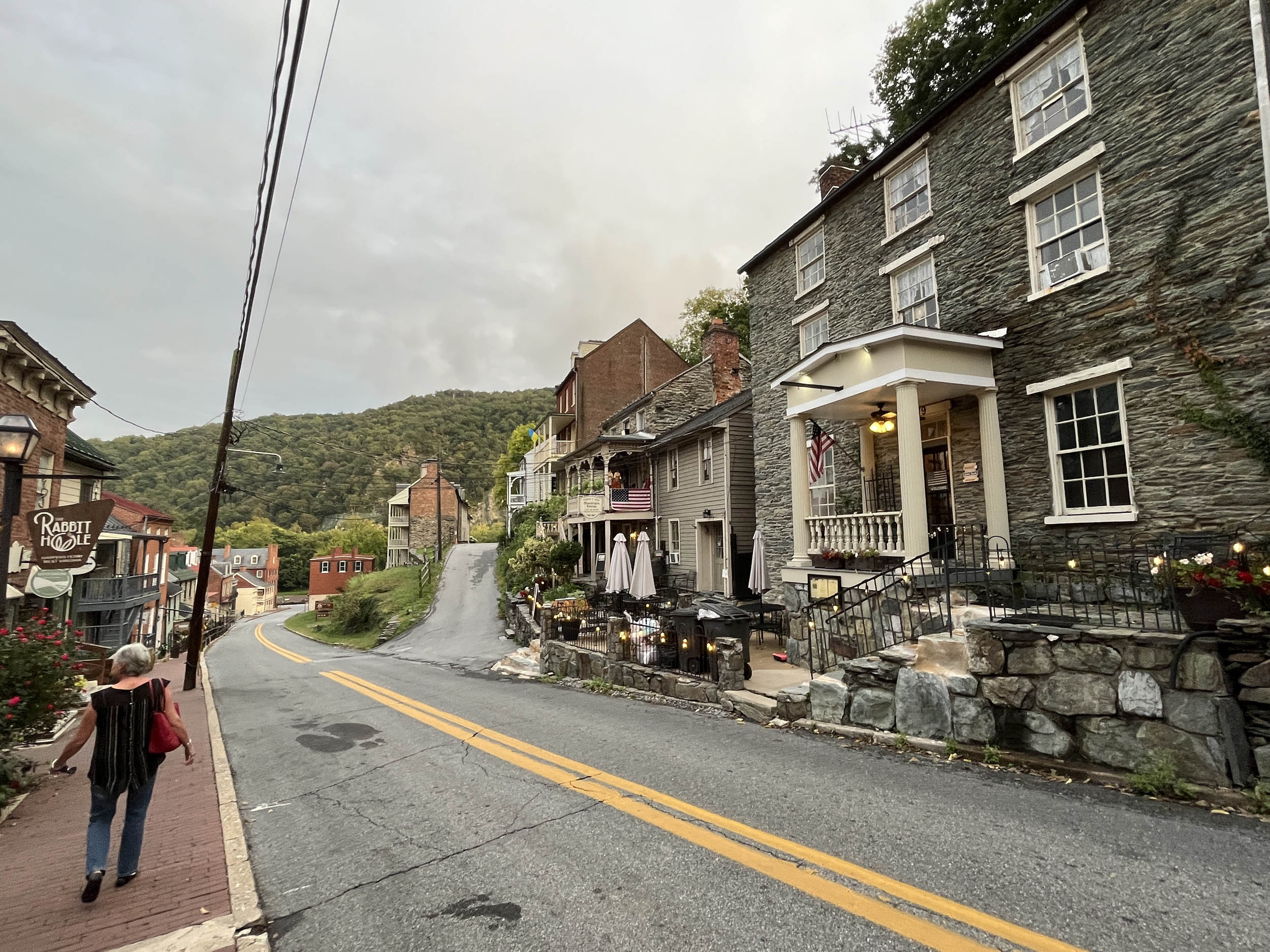
- The hamburgers are large and juicy at The Rabbit Hole in Harpers Ferry, WV
- Don’t pass up an excellent sandwich made at the Deli in Whites Ferry, MD.
Here’s an example itinerary based on 60- to 100-mile days. Some riders might prefer shorter days and others might average longer distances, but this is a solid baseline that a thru-rider might consider for a reasonable bikepacking itinerary. Note that this assumes you’re a fairly seasoned rider carrying a medium load.
location Brookville, OH to Washington Court House, OH
Day 1 (70 mi +1,000 ft)
Leaving Brookville, the route quickly enters the Dayton area on bike trails with some minor road riding. The route makes its way to downtown Dayton along the Miami and Mad Rivers, where a statue of Orville and Wilbur Wright provides a nice stopping point to admire the scenery. Reflect on how these two bicycle mechanics changed the trajectory and speed of transportation. While in the Dayton area, stop at the world-class National Museum of the U.S. Air Force at Wright-Patterson Air Force Base. It’s a short detour mostly on bike paths, and admission is free, providing a worthy lesson in aviation history.
The route continues to Xenia, one of the main hubs of developed bicycle paths in Ohio, where five different long-distance routes intersect at the old train depot. Between Xenia and Jamestown, camping is available at Caesar Ford Park Campground. While in Jamestown, stop at Kelly’s Pub for an excellent meal. Washington Court House provides most necessary services, though camping options are limited.
location Washington Court House, OH to Chillicothe, OH
Day 2 (35 mi +600 ft)
This is a very short day that can be combined with either the previous day from Brookville, OH, or the following day into Athens, OH. If combined with the following day to Athens, be prepared for significant steep climbing with limited resupply options until arriving in Athens.
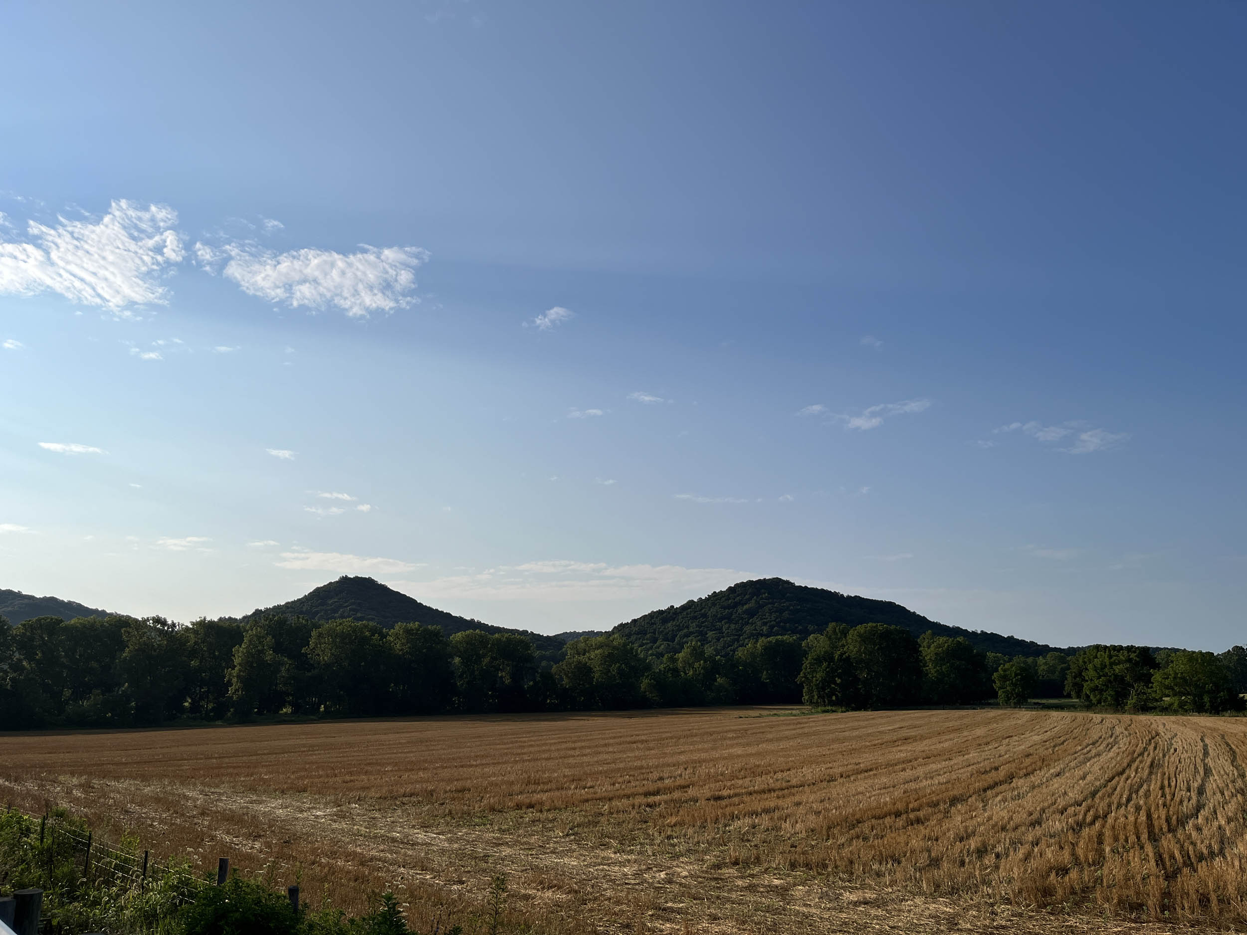
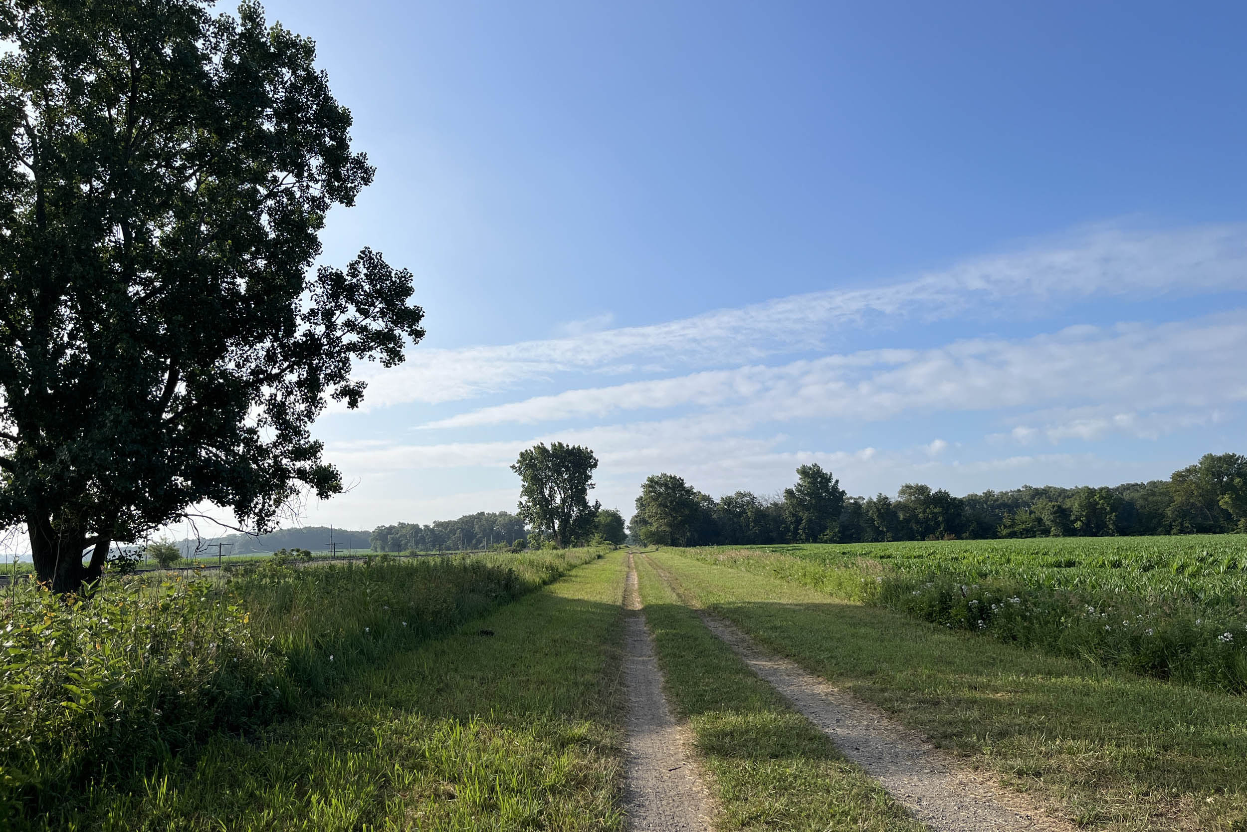
The distance between Washington Court House and Chillicothe is mostly on the Paint Creek Trail as it makes its way across the last portions of flat, uniform farmland on the route. Just before arriving in Chillicothe, the route passes by the Hopewell Mound Group Unit, part of the Hopewell Culture National Historical Park. The park has preserved and interprets 2,000-year-old monumental mounds and earthen enclosures built by the Hopewell Native Americans. Spend some time in downtown Chillicothe, where plentiful resupply and excellent restaurants dominate.
location Chillicothe, OH to Athens, OH
Day 3 (65 mi +3,700 ft)
Leaving Chillicothe, the route says goodbye to the flat farmlands of the Midwest as the foothills of the Appalachian Mountains appear on the horizon. Riders quickly enter the Tar Hollow State Forest area on low-traffic and very steep roads. Clark Hollow Road will challenge the legs and lungs of riders, providing one of the steepest climbs of the entire route, peaking at 23%. It’s not long, but it is certainly challenging. Camping is available in this area, but it is off-route and provided by the state park system.
This area is also home to the Amish, so horse-drawn buggies and farms without electricity can be seen. Many Amish don’t like having their picture taken, so be respectful and at least ask before taking pictures.
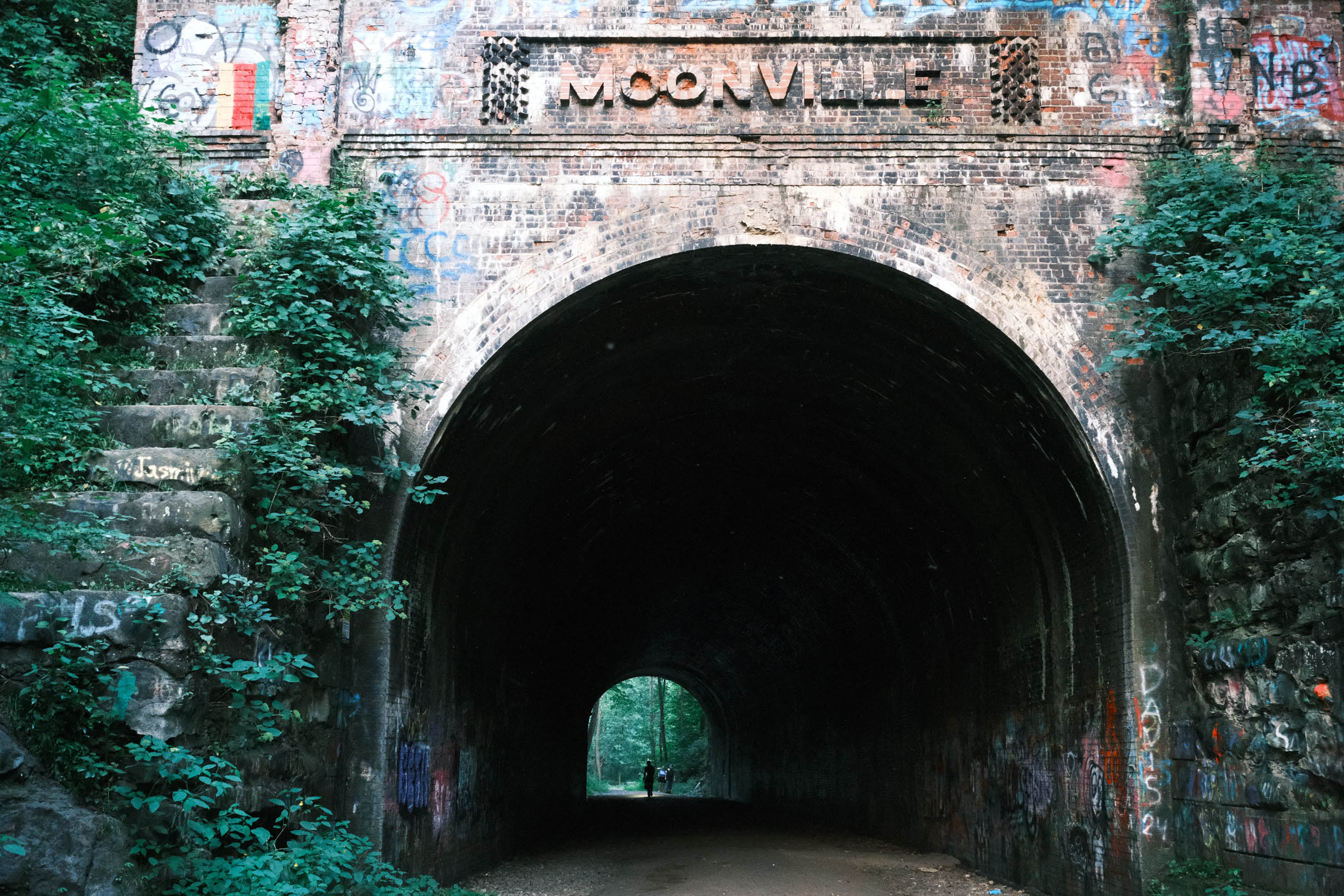
In Zaleski, the Moonville Tunnel Trail originates and can be rough for about 6 miles before arriving at the tunnel. After the tunnel, the surface improves significantly before ending, then more steep climbing is needed to get to Athens, where the route goes right through the heart of the Ohio University campus. Athens is a large town with full services, including several breweries.
location Athens, OH to Ellenboro, WV
Day 4 (79 miles +3,160 ft)
Leaving Athens, the route continues on the Hockhocking Adena Bikeway until it ends east of Athens, where lightly trafficked backcountry roads with a good dose of gravel lead to Parkersburg, WV. At Parkersburg, the route crosses the Ohio River, entering another new state where the journey enters the heart of the Appalachian Mountains, where coal, coke, railways, and steel once dominated.
In Parkersburg, take a sternwheeler riverboat over to Blennerhassett Island State Park and visit the restored mansion of Harman Blennerhassett, where in 1805 he allowed the estate to become headquarters for Aaron Burr’s attempted treasonous plot to create a new country independent of the United States.
Outside of Parkersburg, the route picks up the North Bend Rail Trail for the next 72 miles, where riders pass through 10 tunnels on their way to Clarksburg. Bring lights, as none of the tunnels are lighted.
Stop in Cairo and visit the North Bend Rail Trail Foundation’s headquarters in the unique old bank in the tiny town. A small restaurant and convenience store are also available when open.
Here is where riders will need to make a decision and plan for the next day. Abundant wild camping is available along the North Bend Trail, in addition to developed campgrounds at North Bend State Park before reaching Ellenboro and at the Doddridge County Campground near Smithburg. Riders can also find lodging and services in Ellenboro.
However, lodging and camping are non-existent between the end of the North Bend Trail and Morgantown, WV. Resupply is abundant, but sleeping arrangements are difficult, except for hotels on the far eastern side of Clarksburg, which require riding on very busy roadways. Therefore, it is advisable to either camp somewhere along the trail or stay in a hotel in Ellenboro, then ride to Morgantown the next day.
location Ellenboro, WV to Morgantown, WV
Day 5 (99 mi +2,000 ft)
Assuming the rider is leaving Ellenboro, the route continues on the remote North Bend Trail, with abundant former railroad infrastructure visible. The passage through dark, damp, and cool tunnels continues all the way to Wolf Summit, where the route follows lightly trafficked roads into Clarksburg.
The route picks up the North Harrison Trail in Clarksburg, starting the process of following the West Fork River to Fairmont. The North Harrison Trail has been significantly improved over the years, though there are still some very bumpy sections. It feels downright smooth compared to the huge ballast stones and massive mud pits that used to be on it.
Picking up the West Fork Trail in Shinnston, riders are treated to a nice, smooth trail all the way to Fairmont. At the end of the trail, there is a very short, punchy 20%+ grade climb into Fairmont proper. Fairmont is a full-service town, but again lodging is difficult to ride to. Find some West Virginia original pepperoni rolls for a hearty snack and buy some extras, as they are easy to carry on a bike.
After riding through Fairmont, follow the MC Trail to Prickett’s Fort State Park and visit a reconstructed fort that commemorates late 18th-century life on the Virginia frontier. The Mon Trail begins at the state park, following the Monongahela River to Morgantown, where services abound at the home of West Virginia University.
location Morgantown, WV to Meyersdale, PA
Day 6 (100 mi +3,900 ft)
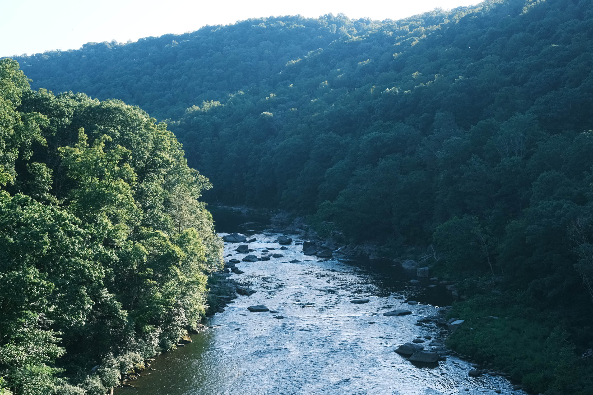
Shortly after leaving Morgantown on the Caperton Trail and North Mon Trail, the route passes the massive Fort Martin Power Station on the opposite side of the river, providing an up-close look at a coal-fired power plant. A few miles later, the route enters the Commonwealth of Pennsylvania via the Sheepskin Trail, which ends in Port Marion, PA.
Port Marion is located alongside the Monongahela River at the mouth of the Cheat River. This is where a major break of approximately 30 miles occurs between the many rail trails in West Virginia and the famous Great Allegheny Passage (GAP). This is another area where the route provides many punchy, short, and rolling hills, with a few requiring 20% climbing to reach the top. After some good climbing, stop in Dunbar at JB’s Market for a delicious hot Italian sub sandwich.
Not too far from Dunbar, the route enters the GAP at mile marker “89.” There are abundant services along the fine and smooth crushed-limestone surface of the GAP, providing the opportunity to break this long day into two shorter days of riding. Camping and lodging are available in many of the towns along the GAP. Ohiopyle, PA, provides an excellent opportunity for a break, lodging, and camping. Take some time to visit the world-famous Frank Lloyd Wright Fallingwater house. Make sure to buy tickets early to see a house that is more art than dwelling.
After crossing several cool bridges and trestles, the day ends in Meyersdale, PA, where camping is available at the Festival Point Campground.
location Meyersdale, PA to Hancock, MD
Day 7 (93 miles +900 ft)
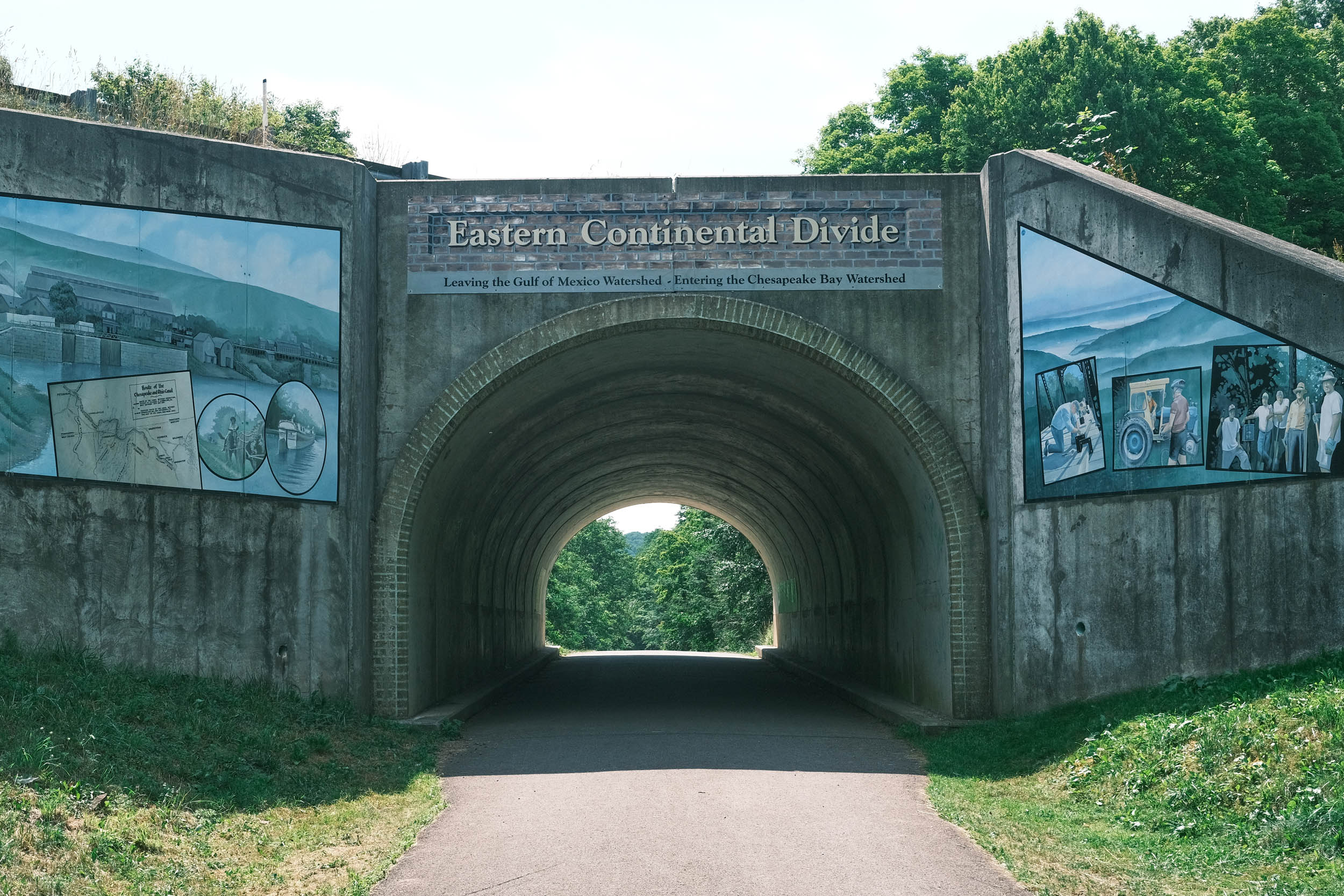
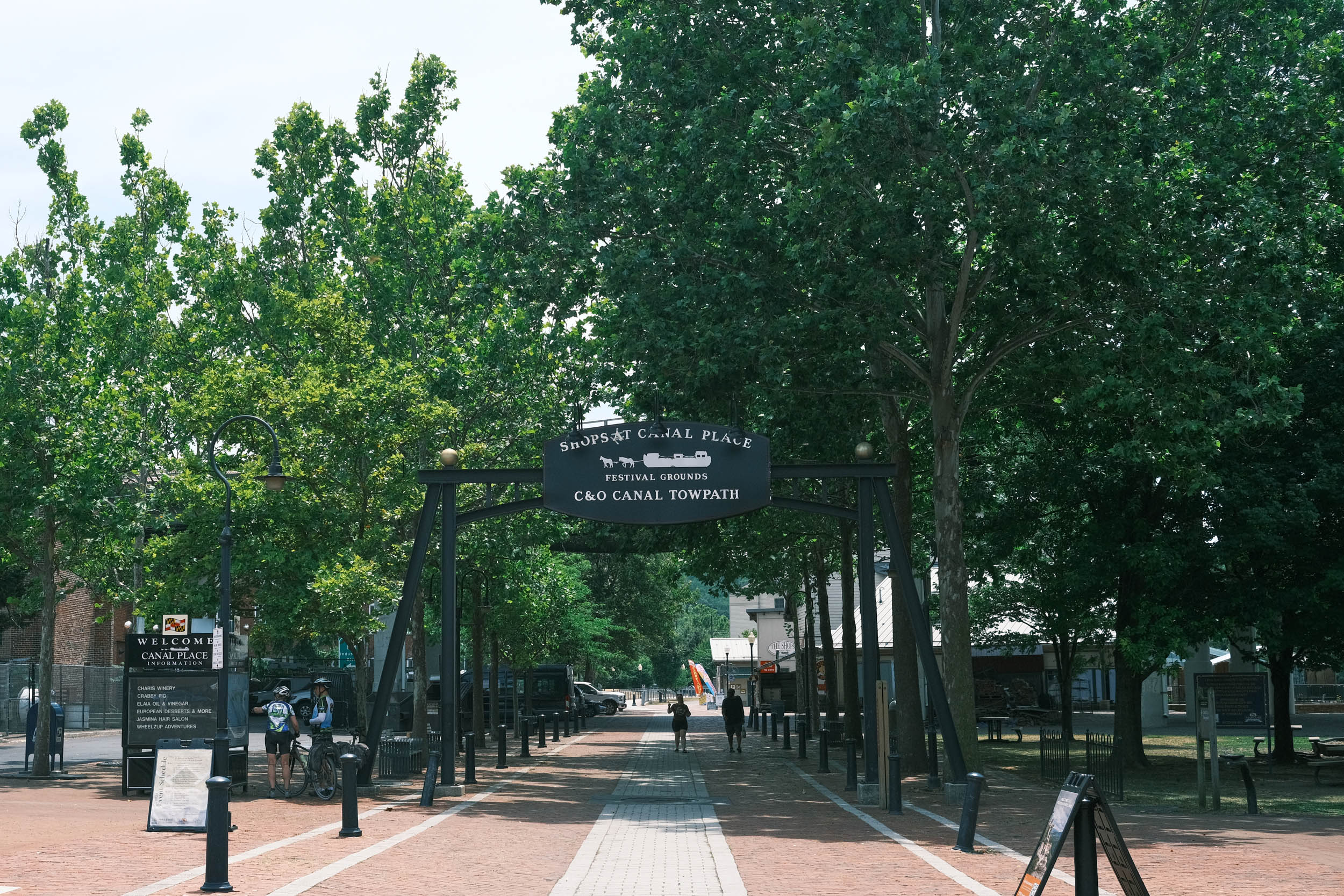
Miles continue to come easily as the route passes the Eastern Continental Divide of the United States, where the water flows into the Atlantic instead of the Gulf. Reaching the divide provides the opportunity for a 20+ mile downhill ride all the way to Cumberland, MD, where the GAP ends and the Chesapeake and Ohio (C&O) Canal National Historical Park begins.
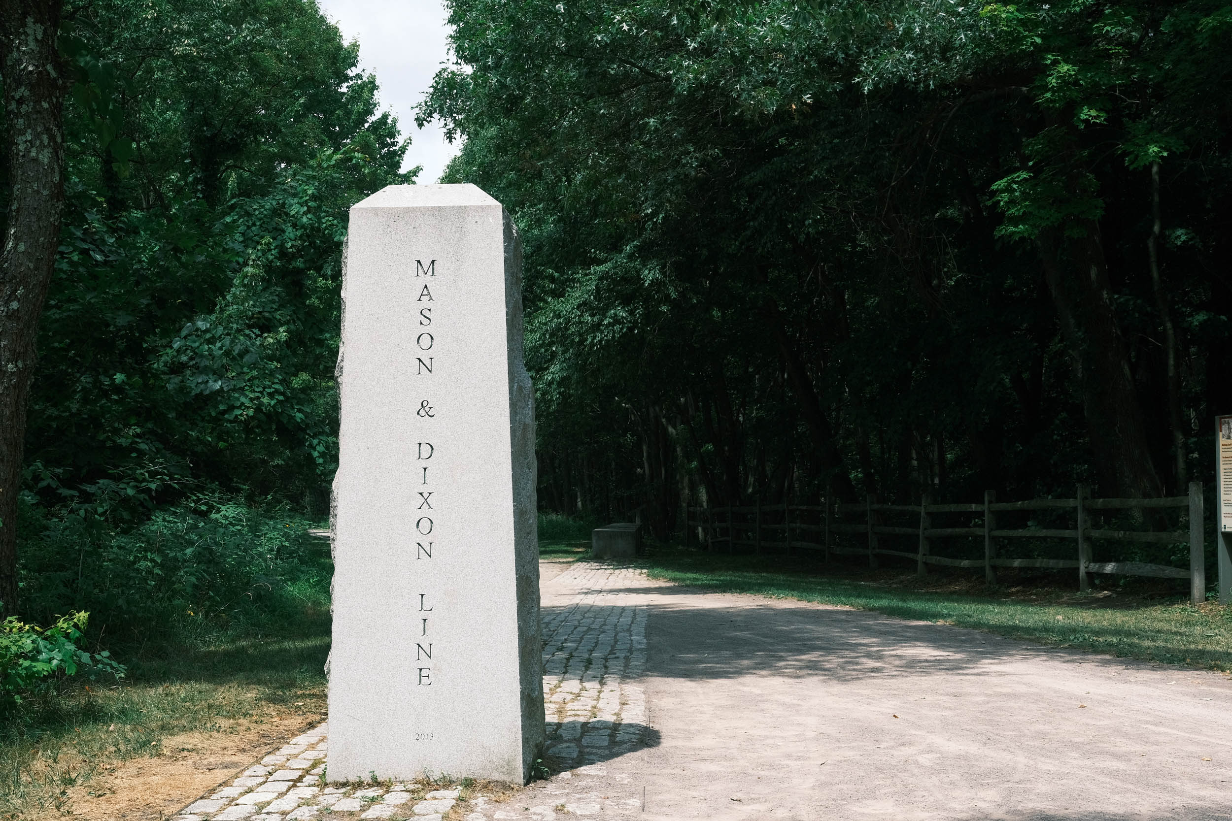
Before Cumberland, the route goes through the impressive 3,300’ long Big Savage Tunnel, followed shortly by the expansive views at Big Savage Vista. Shortly after Big Savage, the GAP crosses the Mason-Dixon Line, marking the historical boundary between Pennsylvania and Maryland.
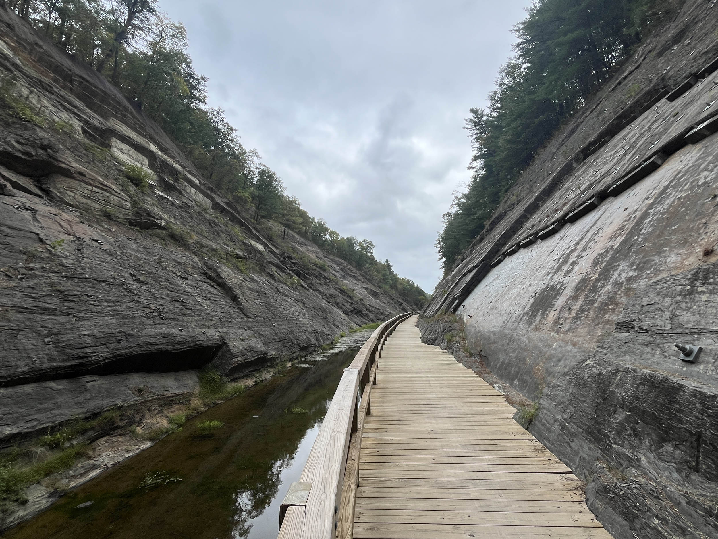
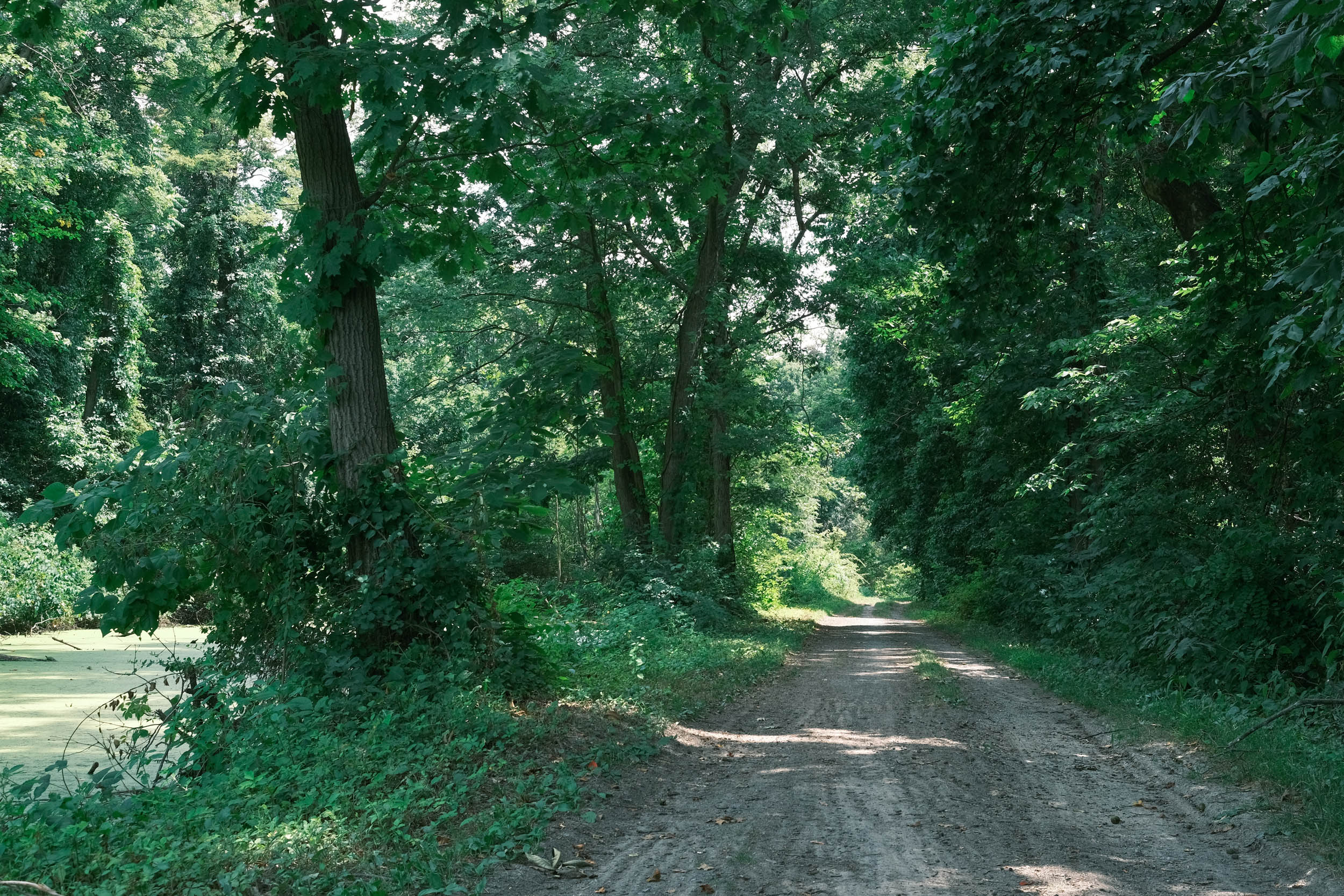
Cumberland is a large town with all of the necessary services. There are an enormous number of designated camping opportunities along the C&O, most with hand pumps for water and portable toilets. The trail is very flat with mostly good surfaces, but not up to the standards set by the GAP. Before reaching Hancock, the route goes through the Paw Paw Tunnel, which is the last tunnel on the route and is quite unique, as the old canal passes through a ridge. There is a towpath in the tunnel that is rideable, but many prefer to walk their bikes through this dark and tricky section of the route.
location Hancock, MD to Harpers Ferry, WV
Day 8 (67 mi +700 ft)
Leaving Hancock, the route continues on the C&O, passing many of the historical locks and lock houses. Check with the National Park Service, as some of these lock houses are available for rent. Camping continues to be plentiful, as do other historical sites, with none more hallowed than Antietam National Battlefield near Sharpsburg, MD. Antietam is a sacred Civil War site where the bloodiest single-day battle in American history took place.
The day ends at Harpers Ferry, where another national park exists in the middle of a restored mid-19th-century town that was the center of many pre–Civil War and Civil War conflicts.
location Harpers Ferry, WV to the Washington Monument
Day 9 (65 mi +500 ft)
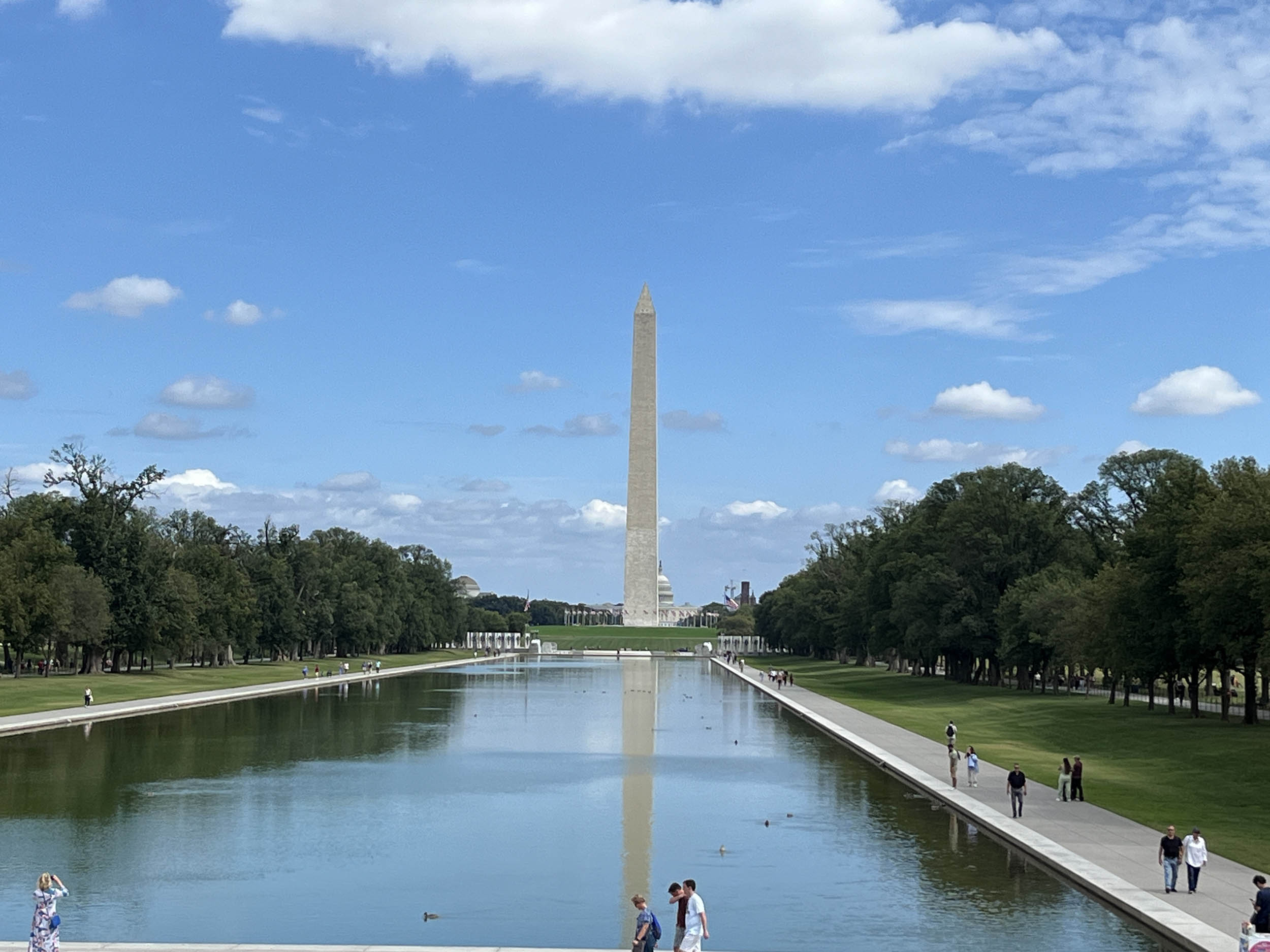
The final day of the great adventure on the GAWR continues on the C&O Canal all the way to Washington, DC. Make sure to stop at the dramatic Great Falls of the Potomac, where kayakers may be seen riding down the many falls of the Potomac River. Heading into DC is interesting, as the C&O provides a remote, nature-focused ride well isolated from urbanization all the way to Georgetown, where the full force of the DC urban landscape appears.
DC is very bike-friendly, providing bike lanes and paths to and around the great memorials along the Lincoln Memorial Reflecting Pool as the route reaches its terminus at the Washington Monument. Congratulations on finishing the cross-country adventure from the Space Needle in Seattle to the Washington Monument in DC! Take a couple of days off and explore the vast number of museums, structures, and important sites in the DC area.
- Here is a comprehensive list of lodging and resupply locations along the entire route. There is also a tab for specific information on individual rail trail segments.
- Visit the Great American Wheel Adventure Facebook page to connect to other riders and racers.


Terms of Use: As with each bikepacking route guide published on BIKEPACKING.com, should you choose to cycle this route, do so at your own risk. Prior to setting out check current local weather, conditions, and land/road closures. While riding, obey all public and private land use restrictions and rules, carry proper safety and navigational equipment, and of course, follow the #leavenotrace guidelines. The information found herein is simply a planning resource to be used as a point of inspiration in conjunction with your own due-diligence. In spite of the fact that this route, associated GPS track (GPX and maps), and all route guidelines were prepared under diligent research by the specified contributor and/or contributors, the accuracy of such and judgement of the author is not guaranteed. BIKEPACKING.com LLC, its partners, associates, and contributors are in no way liable for personal injury, damage to personal property, or any other such situation that might happen to individual riders cycling or following this route.
Further Riding and Reading
Here are some connected/nearby routes and related reports...

Please keep the conversation civil, constructive, and inclusive, or your comment will be removed.